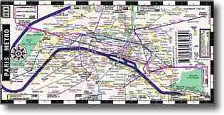
Paris Metro Map : Paris Metro Subway Map
To use the trains, you’ll need a Paris Metro Map to help you find where you need to go, and to work out which connections you need to make – if any.
Every country uses different words for the trains – if you’re from New York, you might call it the Paris Metro Subway Map, if you’re English, you might it a Tube Map, Aussies might call it a Map of the train stations. Whatever you call it, in Paris it’s the METRO.
Rumour has it that there is metro stop within 500 metres of wherever you’re standing in Paris. OK – I have walked for a good 10 minutes before reaching a metro stop, so maybe the 500 metres is stretching it a wee bit :-)
Paris’ website for the Metro : http://www.RATP.fr
You can read more about the Metro in our Getting Around section.
Buy Metro map : Paris city map : Paris metro subway map
You can find Metro Maps all over the place, on the bakc of maps, in touristy shops, at tourist help desks but especially in the train stations where you buy your tickets.
You can also buy a Metro Map before you travel – one which will fit in your wallet, handbag or backpack.
I’ve seen one online today – laminated so it will last – and it folds into 3 and ends up the size of a credit card, so it’s perfect for your wallet or purse.
Study it and get used to the Metro names before you even leave home for the airport. How cool is that?

If you sign up for my POSTCARDS FROM PARIS Newsletter, you’ll get a free Paris Metro Map delivered to your email inbox – can’t get any easier :-)
Simply fill in the form below, or on any page of this website.


LET'S CHAT